FIrewater
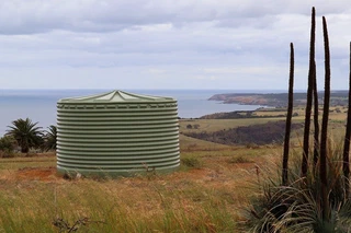
The Firewater project is a Growing Data Foundation initiative developed during the 2020 GovHack competition by the GDF Water Warriors team. The project provides tools and data visualisations to help firefighters identify water sources — dams, reservoirs, tanks and watercourses — so they can make better decisions about water supply during bushfire events.
Using open government datasets on water infrastructure and fire-prone areas, the team built a prototype application that maps available water sources against current and predicted fire zones. The goal is to help incident controllers locate the nearest accessible water supply quickly and safely during fast-moving bushfire events.
The project
The Water Warriors team competed across the 46-hour GovHack 2020 weekend, combining open data from state government agencies, Bureau of Meteorology feeds, and crowd-sourced water-point registers. The resulting prototype was awarded recognition at both state and national level.
The tech
The project uses open government spatial datasets, LoRaWAN sensor data from The Things Network Adelaide, and a web-based mapping interface. All source data and code are published under open licences.
About
FIrewater grew out of the Growing Data Foundation’s ongoing work in open data and community resilience. The Foundation continues to explore how sensor networks and open data can support emergency management across South Australia.